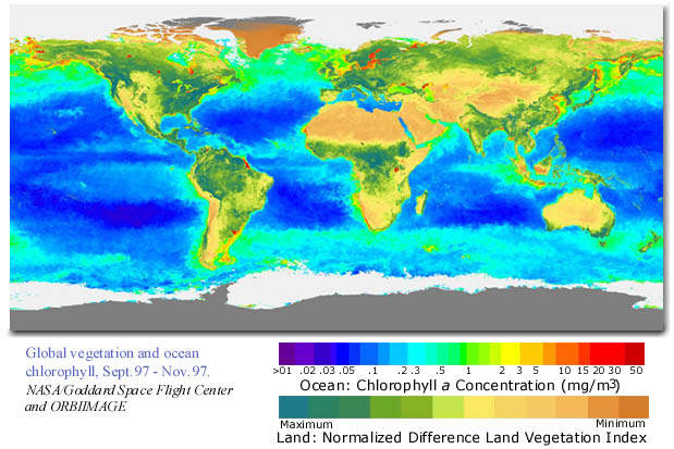
| This SeaWiFS satellite image of the global oceans was created by measuring the color of the sea surface. The color of the sea surface has been associated with different concentrations of chlorophyll in the oceans. Areas with more chlorophyll contain greater concentrations of photosynthetic organisms. On this map, areas of the ocean that are aqua have higher chlorophyll concentrations than areas that are shaded dark blue or violet. The colors on the map are for display purposes and are not the actual colors that the satellite measures. |
![]()