
Historical map of downtown San Diego
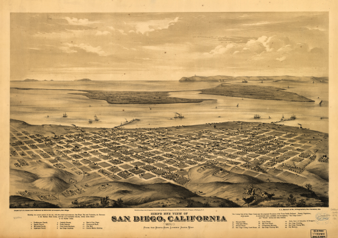
Drawn by E. S. Glover. A.L. Bancroft & Co., lithographers.
Downloaded from The Library of Congress - American Memory, January 16, 2009.
Courtesy Library of Congress, Geography and Map Division.
Call number: G4364.S4A3 1876 .G6
Large zoomable map in JPEG 2000 format
 Larger zoomable image in JPEG 2000 format
• Free viewer that allows JPEG 2000 files to be viewed in your web browser. Recommendation by the Library of Congress.
Courtesy Library of Congress, Geography and Map Division.
Call number: G4364.S4A3 1876 .G6
Large zoomable map in JPEG 2000 format
• Free viewer that allows JPEG 2000 files to be viewed in your web browser. Recommendation by the Library of Congress.
Questions for thought
- Where will the downtown ballpark be built?
- Where is Point Loma?
- Where is North Island and what is different about it today?
- What are the small islands on the upper left horizon?
Related resources
-
The Library of Congress - American Memory
Historical maps (such as the one shown above), photos, sound recordings and more. Search for materials from your community.
Library of Congress
-
Panoramic Maps - 1847-1929
The kinds of map shown above is a panoramic map. It's an aerial-oblique view that shows sinificant features although not to scale. Less commonly used today, but still very useful and informative.
Library of Congress