
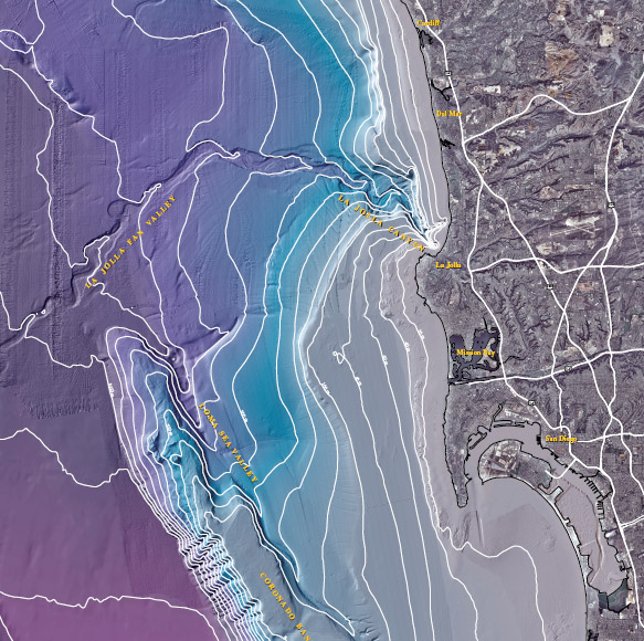
Bathymetric map - La Jolla submarine canyon
Map Source:
U.S. Geological Survey
Dartnell, Peter, Normark, William R., Driscoll, Neal W., Babcock, Jeffrey M., Gardner, James V., Kvitek, Rikk G., and Iampietro, Pat J., 2007, Multibeam bathymetry and selected perspective views offshore San Diego, California: U.S. Geological Survey Scientific Investigations Map 2959, 2 sheets. [http://pubs.usgs.gov/sim/2007/2959].
Version 1.0, June 14, 2007
Initial release online at http://pubs.usgs.gov/sim/2007/2959/
Questions for thought
- What formed La Jolla Canyon?
- How are La Jolla Canyon and Rose Canyon related?
- Where is the edge of the continental shelf?
- How does the shape of the seafloor influence waves at the shore?
Research at SIO
-
Nearshore Canyon Experiment (NCSX)
Scientists study the interaction of waves and underlying topograpny at La Jolla Shores and Black's Beach in San Diego, CA. See what makes the excellent surf and why there are so many rips.
NCEX
-
Black's Beach was 2 1/2-month site for rip current research
News article that talks about Scripps scientist Bob Guza and his research on rip currents.
Article by Terry Rodgers, SignOnSanDiego.com