
Physiography of the San Diego Region - Canyons and Mesas
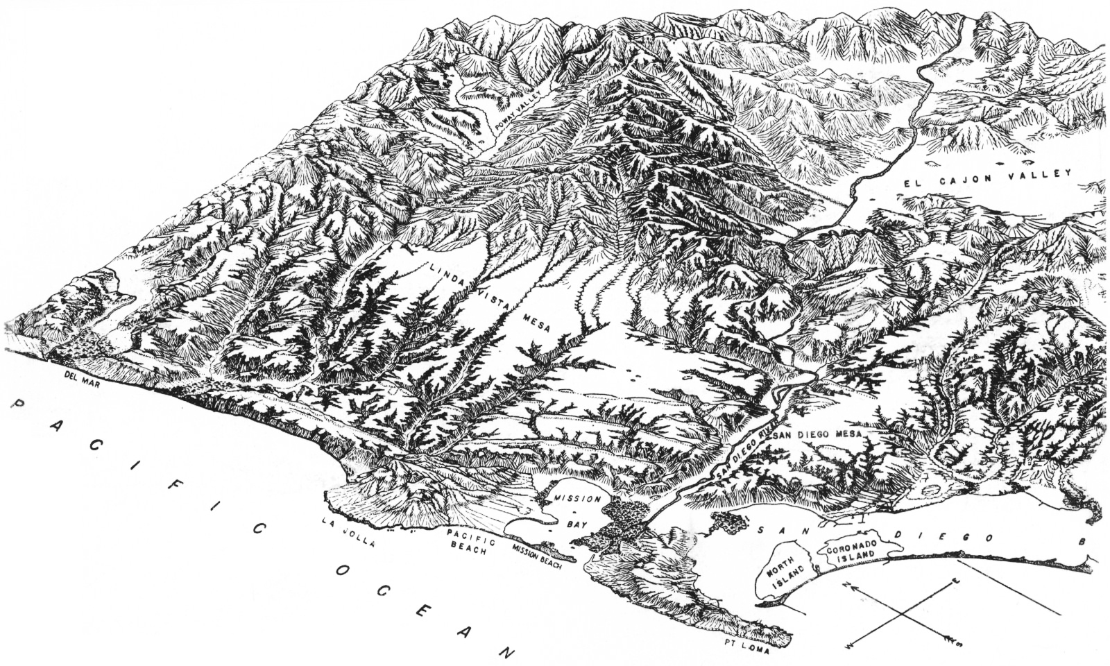
Illustrator - E. H. Quayle, in Hertlein, L. G., and U.S. Grant IV, 1944.
The geology and paleontology of the marine Pliocene of San Diego, California, part 1, geology. Memoir II.
San Diego Society of Natural History, 72 pp., and18 plates.
Courtesy San Diego Natural History Museum.

The geology and paleontology of the marine Pliocene of San Diego, California, part 1, geology. Memoir II.
San Diego Society of Natural History, 72 pp., and18 plates.
Courtesy San Diego Natural History Museum.
Questions for thought
- Find the largest mesa in the region.
- Is your school located on a mesa?
- How is the San Diego topography of mesas and canyons similar to the Grand Canyon area?
Web exploration
- Look at this area on Google Earth. Is it as easy to see the flat mesas on the Google map? Explain why you think yes or no.
- What kind of scientist was U.S. Grant IV?
- How did U.S. Grant IV come to live in San Diego?
- Is U.S. Grant IV, one of the authors of this map, related to a U.S. President?
San Diego Canyons to explore
-
San Diego Canyons Campaign
Maps and other information about San Diego Canyons Sierra Club
-
Tecolote Canyon Natural Park & Nature Center
The City of San Diego
-
San Clemente Canyon Marian Bear Memorial Park
The City of San Diego
-
Friends of Chollas Creek
The City of San Diego
-
Foot Bridges of Bankers Hill

KPBS
-
Kate Sessions Canyon Spruce Street Bridge
Hillquest
-
Maple Canyon Quince Street Bridge
Hillquest
-
Los Peñasquitos Canyon Preserve
The City of San Diego
-
Rose Canyon Open Space Park
The City of San Diego
- Street numbering grids and latitude/longitude - coming soon.