Technical Difficulties
Even before Atlantis left Bermuda on Nov.11, 2000, other members of the science party were contending with last-minute headaches.
Laser-line scanner and Geocompass
First and foremost was the "laser line scanner," a device that structural geologists Jeff Karson of Duke and Stephen Hurst of the University of Illinois at Champagne-Urbana have been designing as a substitute for the "geocompass" they took on numbers of previous submarine dives.
Using a geocompass lets scientists know the exact spatial orientation of rocks jutting from the sides of the outcrops that Alvin surveys. If a rock sample there has been geocompass-oriented before Alvin's grasping arms remove it for later study, researchers will be able to reconstruct its original position. That's important in evaluating how the crust may have moved - or "rotated" - over the eons.
But the geocompass is painstaking and time consuming to use, Karson noted. Each time, Alvin has to stop and extend its grasping arms to carefully rest the device next to the outcrop. And the instrument's sensitive magnetic compass can be disturbed by Alvin's own magnetic fields as well as those in the rocks.
By contrast, the externally-mounted line scanner would use a blue-green laser to "point and shoot" a sample's position as Alvin moves past it. And it orients itself with a gyrocompass, which is unaffected by magnetic fields.
 After the laser scanner arrived aboard Atlantis straight from the manufacturers, the scientists found that it "weighs more than was hoped," Karson said. That's a key concern for the Woods Hole Oceanographic Institution team responsible for the weight-sensitive Alvin. It also proved cumbersome, being larger than the external collection basket where rock samples are stored for return to the surface. The biggest headache was its computer software components, which were "put together at the last minute," Karson added.
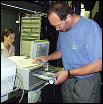
Fig. 1. Co-chief Jeff Karson checking stream of data from instrumentation.
After arriving in Bermuda himself - 10 hours late due bad weather in the Midwest - Hurst boarded the ship and began testing the computer system. His trouble-shooting continued between bouts of seasickness as Atlantis passed though some choppy water. Just about the time that Atlantis arrived in the study area, Hurst was forced to give up for this trip after a final satellite telephone call to its makers. "We found that the hard drive disk was seriously shorting," he said. And there was no backup. The pair, who were previously colleagues at Duke, fortunately brought along their geocompass too.
Another computer bug!
They weren't the only ones with computer problems. Cann and Jennifer Morgan, one of his graduate students at the University of Leeds, arrived in Bermuda from England with another very trouble-prone machine.
"It didn't get delivered back home until two weeks before we came here," said Morgan, who is working on a doctorate in underwater volcanology. "And it apparently had a massive crash of bad processor and mother board. Now we've got our seventh mother board, and our sixth processor. We're just trying to configure some things to put in it. It seems to be losing commands left, right and center. We brought it out with the intention of being a strong computer that could take lots of data and have no trouble processing it. Hopefully it will work, poor little thing!"
Gravimeter
Glenn Sasagawa, a Scripps geophysicist who specializes in instrumentation, had pre-cruise headaches with the pressure casing for two "gravimeters," copper-colored gravity-measuring devices Blackman will rely on to evaluate crust underlying the massif. Things that are denser induce a greater pull of gravity. And gravity studies made during previous expeditions to the massif suggest that blocks of very dense material within its dome, perhaps from the mantle, are being pushed or bent upwards there by some underlying force.
Plans are for Alvin to place the Sasagawa-designed gravimeters on the mountainside with the submarine's grasping arms. As with the geocompass, that requires protecting the instruments from overlying water pressures that can reach almost three tons per square inch. His problem was that the intended gravimeter pressure case design imploded on testing. "So back to the old drawing board," Sasagawa said. "That put us behind schedule. Basically we just hustled to put the new ones together."
Today's pages:
Revisiting the Atlantis Massif | Technical Difficulties | Side-scan Sonar Deployment

|

|
|