Teacher feature
This activity was developed, produced and tested with 6th grade science teachers Amy Weinheimer and Leslie Chadwick at Pacific Beach Middle School in Pacific Beach, California.
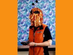
Ms. Weinheimer The "alien" seen with rock in the classroom.
California State Science Standards
6th grade Earth Science
• Plate tectonics
• Energy in the Earth System
• Ecology
from Focus on Earth Sciences• Energy in the Earth System
• Ecology
International Baccalaureate (IB) Program
Common Core Standards
Ocean Literacy Principles
Activity Summary
Part I - Mystery location
The teacher uses narrative and online materials to convey a fantastic opportunity to the class of "aliens" from the planet Hydrus - the discovery of clues to exotic unknown locations on the distant planet Earth.
To solve the mystery, pairs of students deduce a unique location unique based on three geospatial clues. Clues include objects, images, maps and data that require scientific analysis and synthesis to decipher. Mystery locations include an array of places on land and in the ocean.
Clues focus on different content areas -
Students receive confirmation of their mystery location after they complete a short online game that reinforces skill in finding a place on Earth using latitude and longitude coordinates.
Part II - Motivation, authenticity, societal and individual needs, and design
The teacher uses narrative and online materials to relate a common problem on Earth - a shortage of freshwater on a blue planet. The earthlings present the students with an opportunity to trade some of the abundant freshwater on their bland planet for ecotours of the extraordinary, but freshwater-starved Earth. They ask each group to design a travel brochure with some specifications, that will entice interplanetary ecotourists, highligh the natural features and water needs of each location. Given this design challenge, the students devise a strategy and product to promote ecotourism. As a class, they make up a rubric that defines success. They use that rubric later in assessing each other's brochures. The students produce the brochure.
Part III - Assessment - specifications, expertise and persuasion
The students conclude their activity at an open house where they view all the brochures, learn about other locations, share artifacts, evaluate brochures based on the rubric and select favorite locations other than their own.
The teacher uses narrative and online materials to convey a fantastic opportunity to the class of "aliens" from the planet Hydrus - the discovery of clues to exotic unknown locations on the distant planet Earth.
To solve the mystery, pairs of students deduce a unique location unique based on three geospatial clues. Clues include objects, images, maps and data that require scientific analysis and synthesis to decipher. Mystery locations include an array of places on land and in the ocean.
Clues focus on different content areas -
- Clue 1: Rock type that indicates tectonic setting
- Clue 2: Image and/or map that indicates geographic setting - latitude, elevation, land or sea
- Clue 3: Cultural artifact that indicates environmental setting - climate, proximity to ocean, biota
Students receive confirmation of their mystery location after they complete a short online game that reinforces skill in finding a place on Earth using latitude and longitude coordinates.
Part II - Motivation, authenticity, societal and individual needs, and design
The teacher uses narrative and online materials to relate a common problem on Earth - a shortage of freshwater on a blue planet. The earthlings present the students with an opportunity to trade some of the abundant freshwater on their bland planet for ecotours of the extraordinary, but freshwater-starved Earth. They ask each group to design a travel brochure with some specifications, that will entice interplanetary ecotourists, highligh the natural features and water needs of each location. Given this design challenge, the students devise a strategy and product to promote ecotourism. As a class, they make up a rubric that defines success. They use that rubric later in assessing each other's brochures. The students produce the brochure.
Part III - Assessment - specifications, expertise and persuasion
The students conclude their activity at an open house where they view all the brochures, learn about other locations, share artifacts, evaluate brochures based on the rubric and select favorite locations other than their own.
Class setting, time and resource requirements
Number of students: Up to 40 pairs of students working in pairs.
Time - Four weeks, 5 days a week, ~50 minute class, .
Materials - Everyday items, rocks and minerals, printed materials and paper if digital science notebooks not used.
Computers - One per student or group of students with online access, one for presentation (interactive whiteboard useful).
Special features
Green - Activity can be paperless, although materials for print are provided.
Online - Most of this activity is available online, including automated feedback for the learner.
Modular - Subactivities, particularly those online can be used for other purposes without doing the entire multiweek activity.
Fun - Combining science and make-believe
Relevant - Links to relevant current issues
KNOWLEDGE and SKILLS
Prerequisite and Acquired
| Clue 1 - Plate tectonics |
|
| Clue 2 - Climate |
|
| Clue 3- Cultural artifact |
|
| Clue 1 - Plate tectonics |
|
| Clue 2 - Climate |
|
| Clue 3 - Cultural artifact |
|
| Clue 1 - Plate tectonics | |
| • | The existence of atoms |
| Extended | |
| • | TBA |
Project info:
| This activity was produced by Earthguide, the Center for Ocean Sciences Education Excellence (COSEE) - California, and the Enhancing Science Education Through Technology (ESETT) program at the EdTech Department at San Diego Unified School District (SDUSD). Teachers - Amy Weinheimer and Leslie Chadwick at Pacific Beach Middle School, San Diego Unified School District. Educator/web developer - Memorie Yasuda at Earthguide, Geosciences Research Division, Scripps Institution of Oceanography. Educational technologies resource teacher - Mike Senise at ESETT, San Diego Unified School District. Scientist - Dr. Cheryl Peach at COSEE and Scripps Institution of Oceanography. |