Mystery Alien Landing

Analyzing topography visualized by application of echolocation and math


Teacher feature
This activity was developed, produced and tested with 6th grade science teacher Felicia Ryder and her Earth science classes at Wangenheim Middle School in Mira Mesa, California.
Photo of teacher Felicia Ryder standing on the edge of the Grand Canyon. 
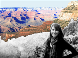
Felicia checks out the actual topography of the Grand Canyon.


California State Science Standards
6th grade Earth Science
•  Plate tectonics and Earth's Structure
•  Energy in the Earth System
•  Ecology
from Focus on Earth Sciences


Activity Summary

Students imagine themselves located at multiple seismic stations that encircle the Earth. Each student receives a unique seismogram for an earthquake that has taken place somewhere in the world. Their collective task is to determine the general location of the earthquake based on seismic wave arrival times.

  • Students reflect on the spatial parameters of the situation and apply what they have learned previously about the nature of P- and S-waves.

  • They combine measurements and analyze the aggregate class dataset. That dataset reveals a distinctive spatial pattern of arrival times that can be used to estimate the location of the epicenter. They evaluate the quality of individual data points and make corrections as needed.

  • Students "discover" the presence of the molten outer core of the Earth and learn about the known layers of the Earth.

Activity style and components


Class setting, time and resource requirements

Number of students: Up to 36 students working in groups of three.

Time - TBA.

Wallspace - place to post 3' x 3' wall chart of cutaway Earth

Computers - one per 2-3 students.


Special features

Green - Activity can be paperless, although materials for print are provided.

Online - Most of this activity is available online, including automated feedback for the learner.

Math - Activity requires applied arithmetic

Analytical reasoning - Activity requires data analysis and quality control judgment.

Collaboration - Activity requires analysis of data collected by others


KNOWLEDGE and SKILLS

Prerequisite and Acquired


Clue 1 - Plate tectonics
  • Knowledge of how arthquake waves propagate through rock.
  • Knowledge of P- and S-waves
  • Ability to interpret seismograms and identify first arrivals of P- and S-waves.
  • Understanding the nature of sound - its sources, how it propagates and behaves at interfaces by producing echoes

Tab 2
Tab 3
Tab 4


Project info:

This activity was produced by Earthguide, the Center for Ocean Sciences Education Excellence (COSEE) - California, and the Enhancing Science Education Through Technology (ESETT) program at the EdTech Department at San Diego Unified School District (SDUSD).

Teacher - Felicia Ryder, Wangenheim Beach Middle School, San Diego Unified School District.
Educator/web developer - Memorie Yasuda at Earthguide, Geosciences Research Division, Scripps Institution of Oceanography.
Educational technologies resource teacher - Mike Senise at ESETT, San Diego Unified School District.
Scientist - Dr. Cheryl Peach at COSEE and Scripps Institution of Oceanography.