Mystery Marine Debris
Analyzing and visualizing topography by application of echolocation
Teacher feature
This activity was developed, produced and tested with 6th grade science teacher Felicia Ryder and her Earth science classes at Wangenheim Middle School in Mira Mesa, California.
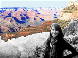 Felicia checks out the actual topography of the Grand Canyon.
Felicia checks out the actual topography of the Grand Canyon.
Activity Summary
Students imagine themselves located at multiple seismic stations that encircle the Earth. Each student receives a unique seismogram for an earthquake that has taken place somewhere in the world. Their collective task is to determine the general location of the earthquake based on seismic wave arrival times.
- Students reflect on the spatial parameters of the situation and apply what they have learned previously about the nature of P- and S-waves.
- They combine measurements and analyze the aggregate class dataset. That dataset reveals a distinctive spatial pattern of arrival times that can be used to estimate the location of the epicenter. They evaluate the quality of individual data points and make corrections as needed.
- Students "discover" the presence of the molten outer core of the Earth and learn about the known layers of the Earth.
Activity style and components
- Style
Problem - Where did an earthquake occur (where is the epicenter)?
Discovery - The existence of the molten outer core
Scientific methods - How indirect observations let us know about the interior of the Earth
- Content components -
Earth science - seismology, epicenter determination, interior layers of the Earth
Math - units, equations, rates
Physics - seismic waves, velocity
Technology - seismographs and remote sensing
Mapping - cross-sectional views and diagrams
History - 1906 San Francisco earthquake and its detection in Germany
- Skill components
Basic
Individual - graph (seismogram) reading
Team - dependence on delegated results, error analysis and quality control, analysis
Extended
Individual - how to deal with units in ratios representing rates
Team - wave refraction and its qualitative effect on seismic body waves
Class settings, time and resources requirements
Time - 3 days
Number of students accommodated - 36.
Wallspace - place to post 3' x 3' wall chart of cutaway Earth
Computers - one per 2-3 students.
Prerequisite knowledge and/or subsidiary activities
- Knowledge of how arthquake waves propagate through rock and at the surface
- Knowledge of P- and S-waves
- Ability to interpret seismograms and identify first arrivals of P- and S-waves.
- Understanding the nature of sound - its sources, how it propagates and behaves at interfaces
| TBA |
| TBA |
Project info:
| This activity was produced by Earthguide, the Center for Ocean Sciences Education Excellence (COSEE) - California, and the Enhancing Science Education Through Technology (ESETT) program at the EdTech Department at San Diego Unified School District (SDUSD). Teacher - Felicia Ryder at Wangenheim Middle School, San Diego Unified School District. Educator/web developer - Memorie Yasuda at Earthguide, Geosciences Research Division, Scripps Institution of Oceanography. Educational technologies resource teacher - Mike Senise at ESETT, San Diego Unified School District. Scientist - Dr. Cheryl Peach at COSEE and Scripps Institution of Oceanography. |