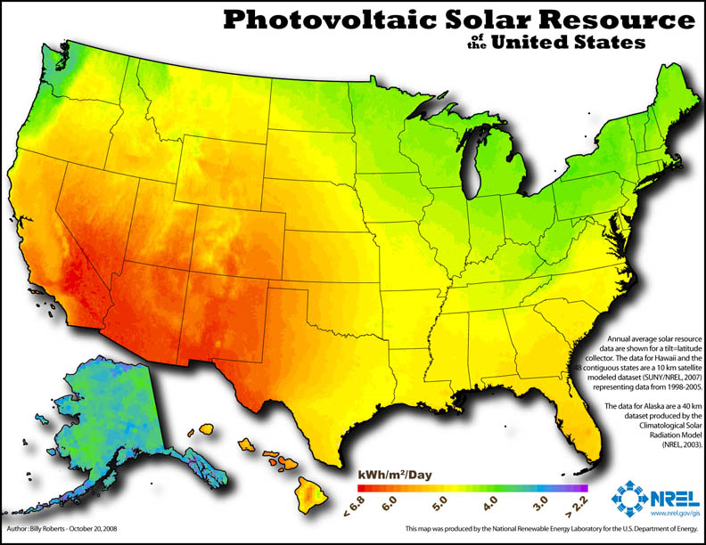

Photovoltaic resource of the United States
Map shows how much of the solar resource, i.e. sunlight, is available for solar collectors placed at a fixed angle across the U.S. Takes into account factors such as cloudiness, atmospheric water vapor, atmospheric trace gases and aerosols. For example, even at low latitude, where it is often cloudy the photovoltaic resource availability might be low.
National Renewable Energy Laboratory (NREL), U.S. Department of Energy
National Renewable Energy Laboratory (NREL), U.S. Department of Energy
Questions for discussion
|
Take away concepts
|