
Depth of the seafloor
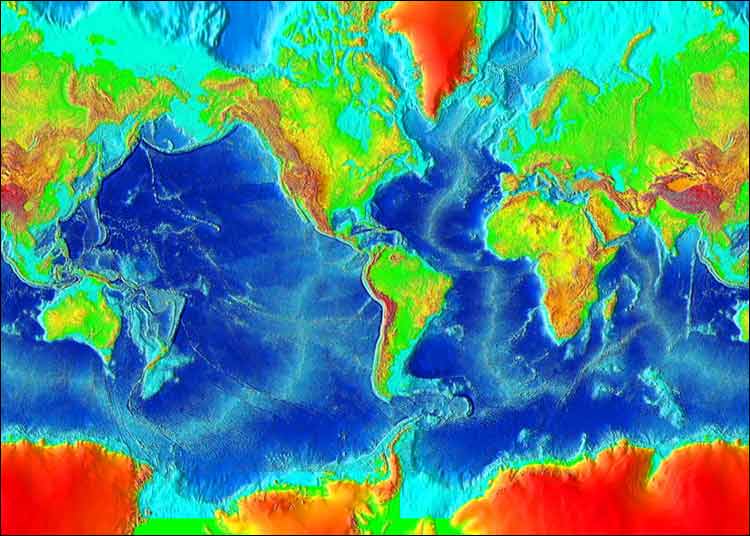

Image from computerized digital images
and associated databases available from
the National Geophysical Data Center (NGDC),
National Oceanic and Atmospheric Administration,
U.S. Department of Commerce.
and associated databases available from
the National Geophysical Data Center (NGDC),
National Oceanic and Atmospheric Administration,
U.S. Department of Commerce.
Ideas
- Discuss the nature of color-contour maps.
- Discuss meaning of specific colors according to the scale
- Identify significant topographic features of the Earth's surface
- Introduce vocabulary
- Practice identifying geographic features
- Discuss how this map was produced.
- Speculate on the origin of significant features
Questions for thought
- How deep is the seafloor around Hawaii? How long would it take you to walk that distance if it were horizontal and not under water?
- Which continent is larger - South America or Antarctica? Look at a globe for comparison. Why is the area of Antarctica so much less on a globe?
- How is elevation of any place on land determined?
- How is the depth of any place on the seafloor determined?
Related resources
-
Surface of the Earth (ETOPO2v2) 2 minute color relief images
More maps like the one shown here.
National Geophysical Data Center